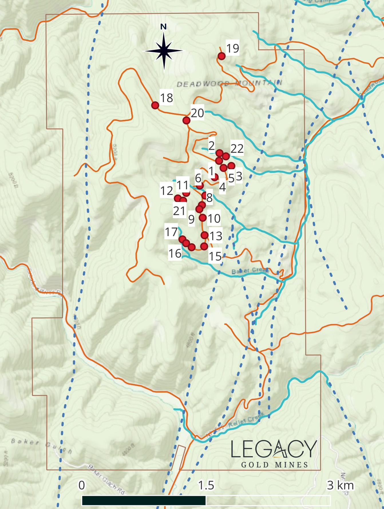
Baner Goldmine Property Maps


Legacy – Figure 2 map for Baner Permit #2 application – April 12, 2026
Download

Legacy – Drill Pads
Download

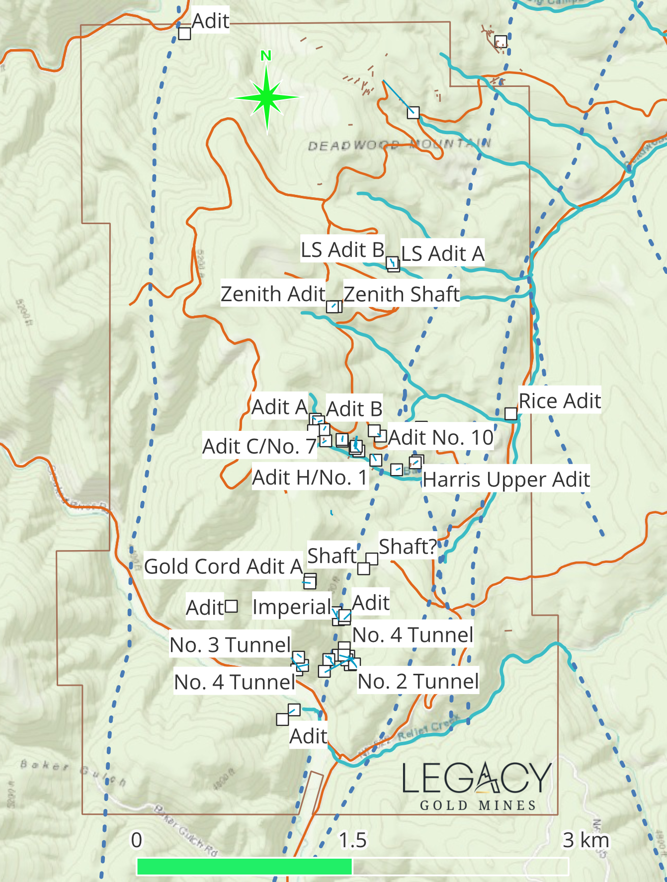
Legacy – Mine Density
Download

Legacy – Faults, Creeks and Rivers
Download

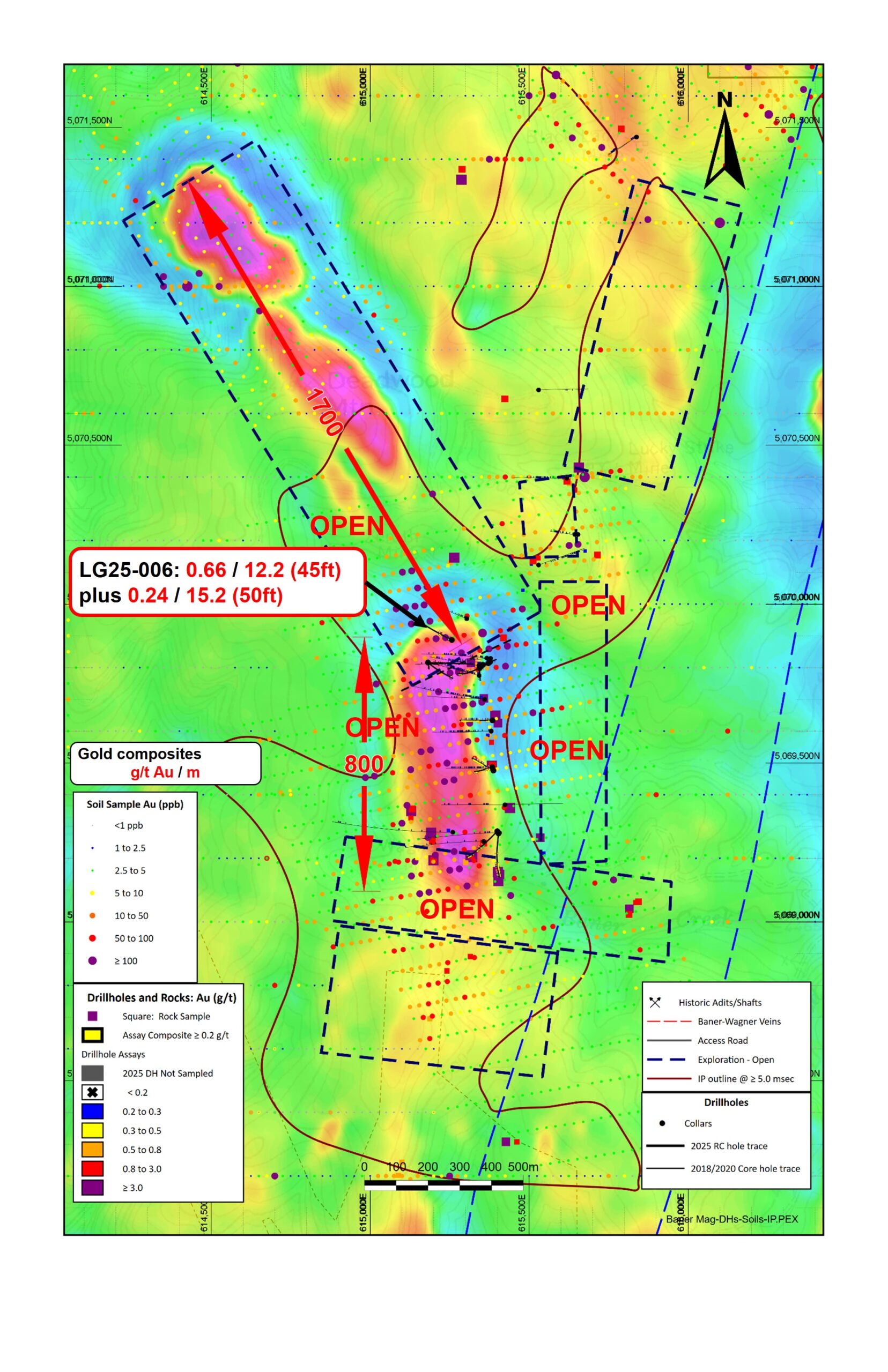
Legacy – Mag Image
Download

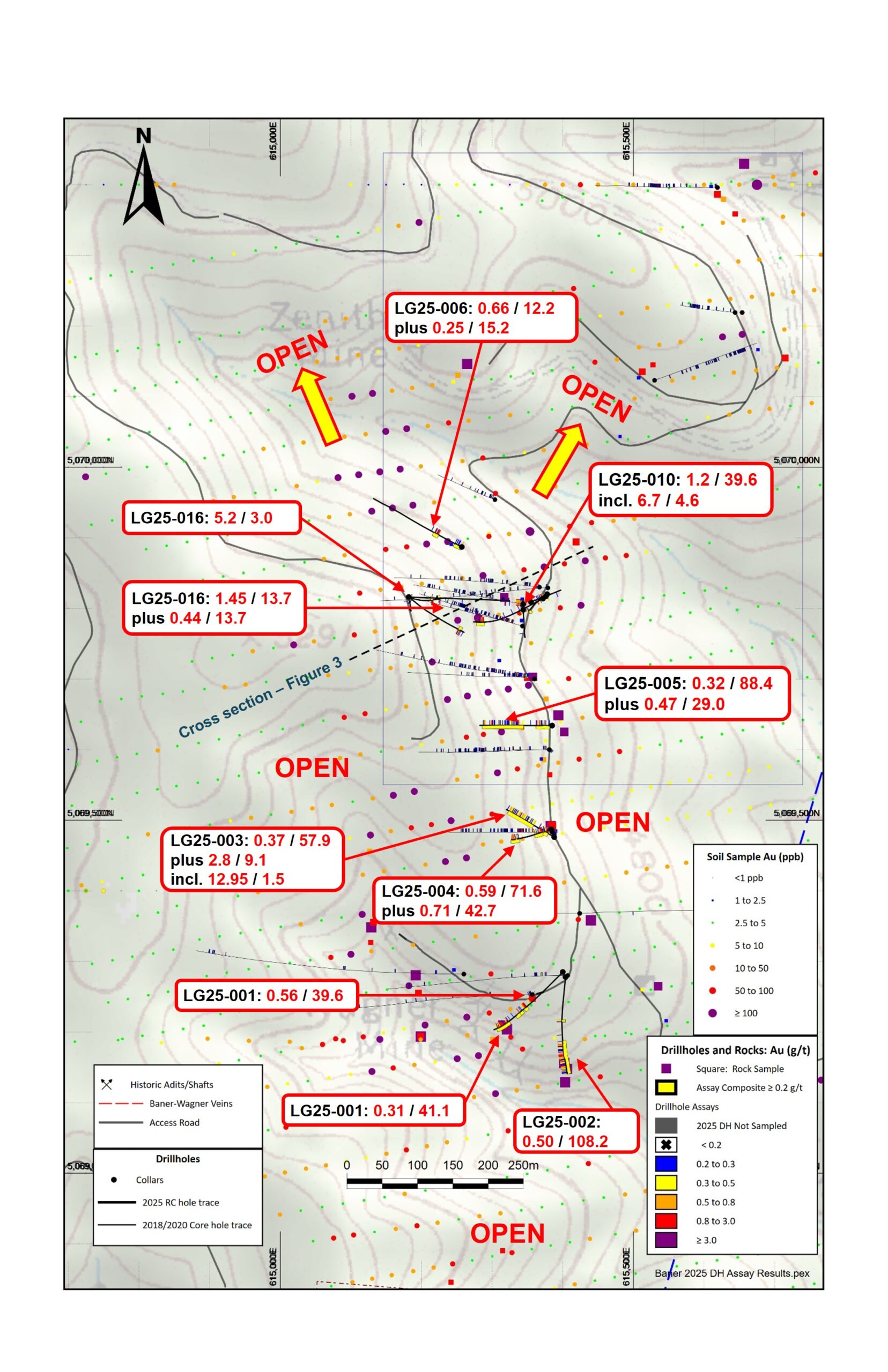
Legacy – Plan Image
Download

Legacy – ≥ 10 g:t intercepts, 3d view from SW looking to NE
Download
Legacy – ≥10 g:t intercepts (natural log plot)
Download
.")
Legacy – ≥5 g:t intercepts (natural log plot)
Download
